OsmAnd 4.1 (iOS)
Hi, Everybody!
Great news for iOS OsmAnd users! We're glad to announce the new OsmAnd version for iOS. Update OsmAnd to check out all new features and let us know if you like them!
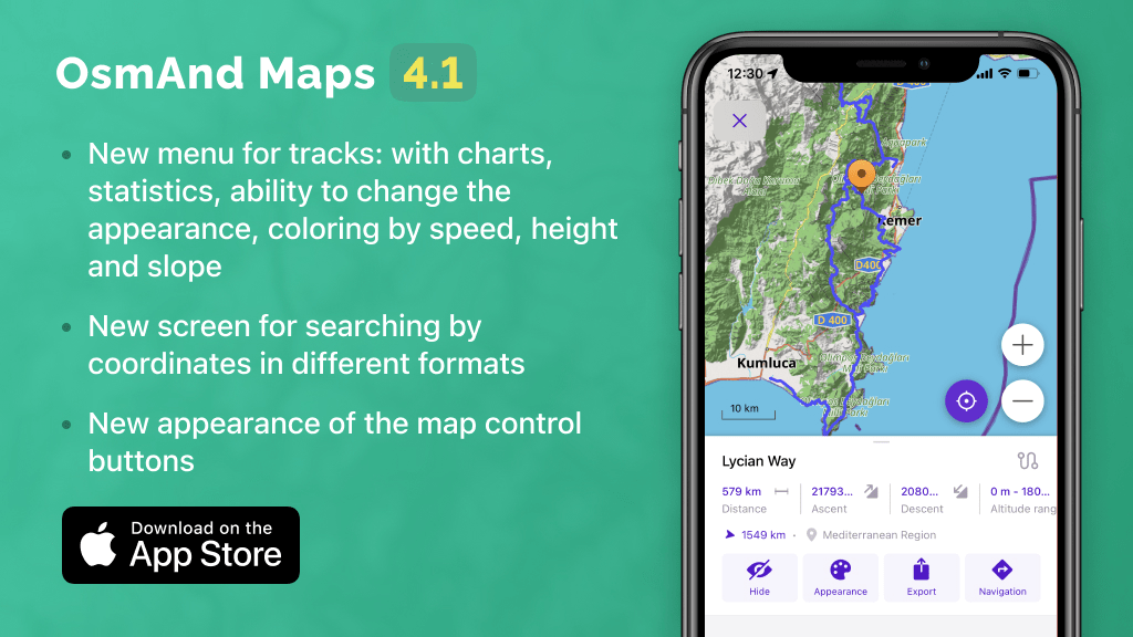
This is a short list of many changes happened in 4.1 release:
- Completely redesigned interaction with tracks
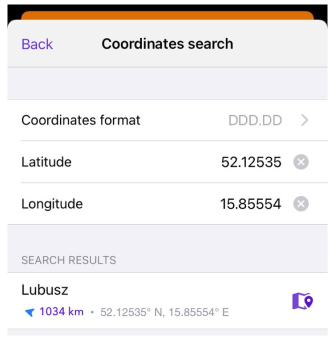
- New screen for searching by coordinates in different formats
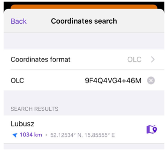
- Improved coordinate search in OLC format
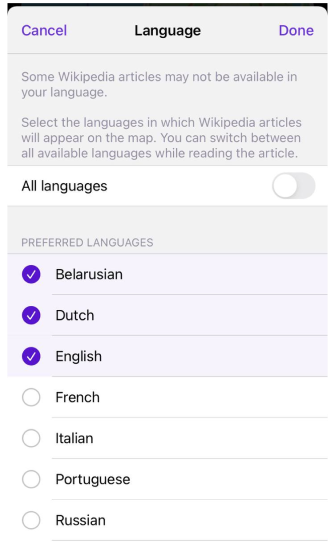
- New user-friendly menu for choosing languages to display Wikipedia articles on the map
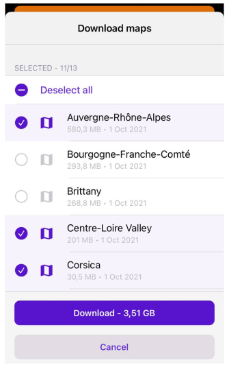
- Added ability to easily load maps of all regions of the country with a couple of clicks
- Added contour lines in feet (You need to re-download files)
- Downloading maps by clicking to the map
- New appearance of buttons on the map and added ability to change map zoom by double-tapping and swiping
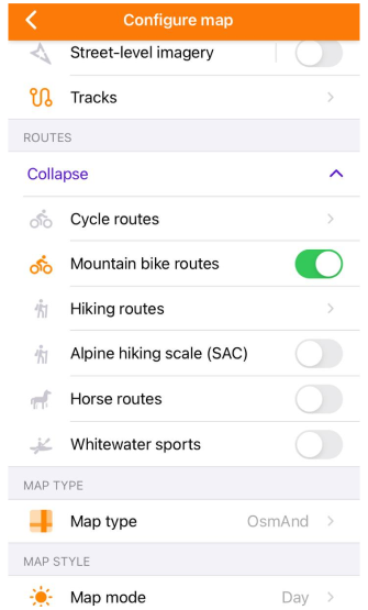
- Route visibility control is moved to a higher level in the "Configure map" menu with the option of flexible settings
Completely redesigned interaction with tracks
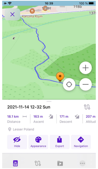
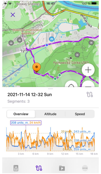
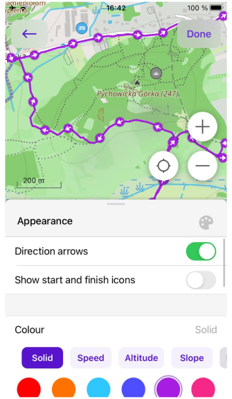
Completely redesigned interaction with tracks: a new menu with charts, statistics, ability to change the appearance, coloring by speed, height and slope, and track selection on the map.
Just click on chosen track on the map or open it by "My Places" menu to enable"Track context menu".
 |  |  |
New screen for searching by coordinates in different formats
We will add the new screen for coordinates search menu.
 |
Improved coordinate search in OLC format
Upgraded coordinates search in OLC format.
 |
New user-friendly menu for choosing languages to display Wikipedia articles on the map
Changed the Configure map menu for choosing languages for wiki articles.
 |
Added ability to easily load maps of all regions of the country with a couple of clicks
Now, you can download region maps of any country by the bundle.
 |
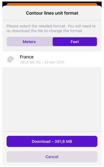
Added contour lines in feet (You need to re-download files)
We added contour lines maps in feet.
 |
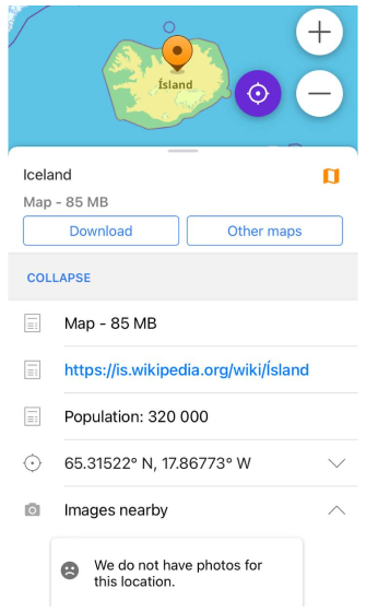
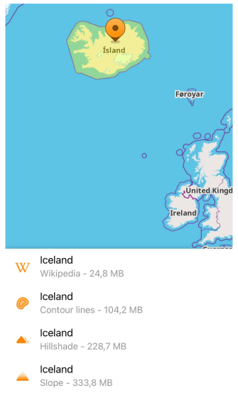
Downloading maps by clicking to the map
Added ability to download maps by selecting the desired region or country on the map, as well as adding a dialog box with the suggestion to load the map if the region is viewed without a map.
 |  |
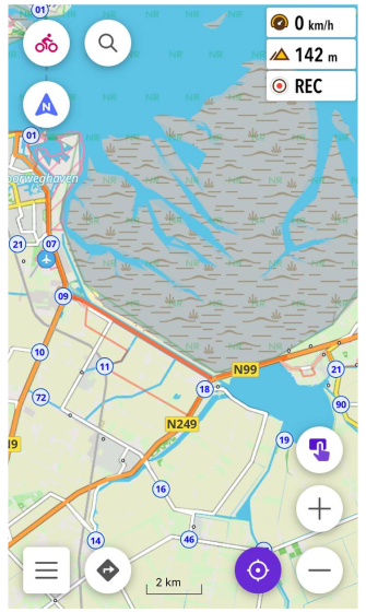
New appearance of buttons on the map and added ability to change map zoom by double-tapping and swiping
New buttons and new gestures on the general screen.
 |
Route visibility control is moved to a higher level in the "Configure map" menu with the option of flexible settings
New routes menu in Configure map menu.
 |
And remember that only together we can achieve the best results! New features are coming SOON!
Follow OsmAnd on Facebook, TikTok, Twitter, Reddit, and Instagram!
Join us at our groups of Telegram (OsmAnd News channel), (EN), (IT), (FR), (DE), (UA), (ES), (BR-PT), (PL), (AR), (TR).